Index of /public/incident_specific_data/pacific_nw/Z_2023_HISTORIC/2023_Incidents_Washington/2023_CowlitzComplex_WA_GPF_001297/Maps/20230901
Name
Last modified
Size
Description
Parent Directory
-
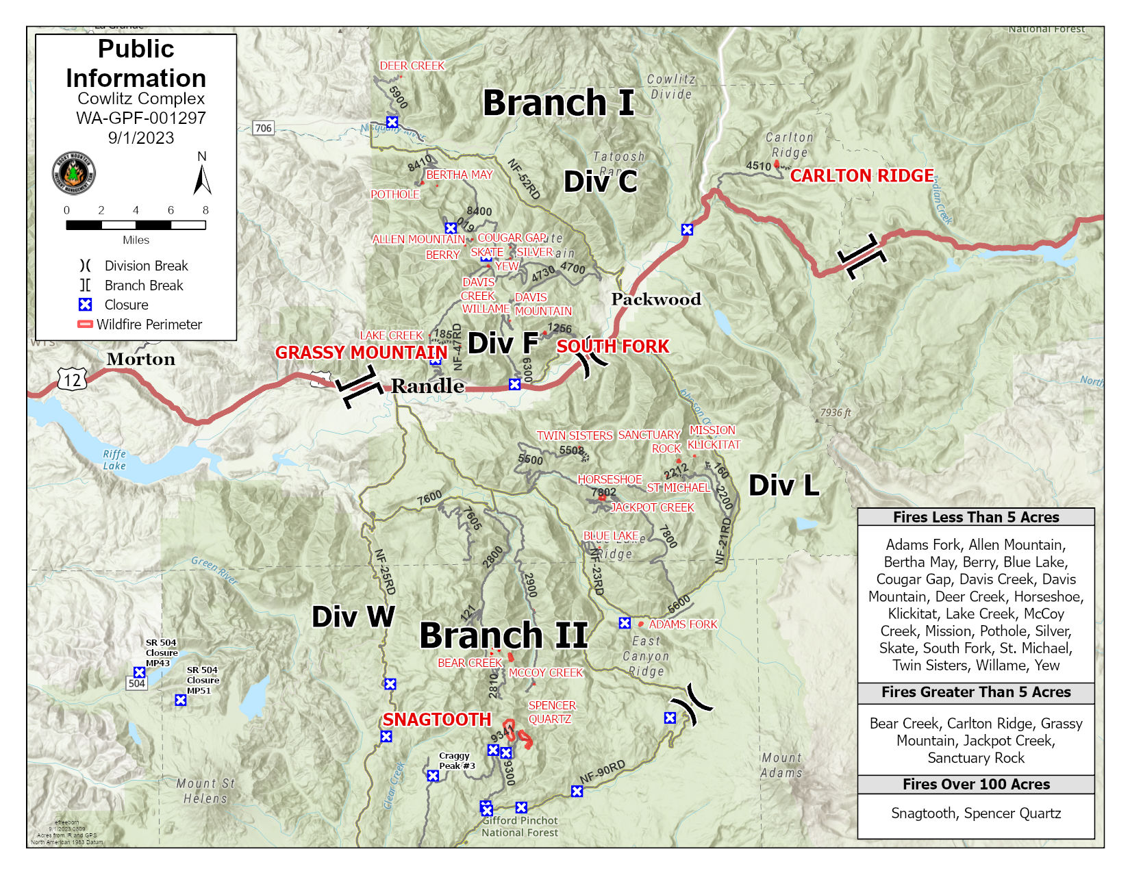
pio_arc_c_land_20230901_809_Cowlitz Complex_WAGPF001297.jpg
2023-09-01 10:17
499K
owner_85x11_land_20230831_2128_Cowlitz Complex_WAGPF001297.pdf
2023-09-01 00:10
2.1M
pio_with_firelist_85x11_land_20230831_2155_Cowlitz Complex_WAGPF001297.pdf
2023-09-01 10:17
2.9M
Branch1_e_land20230831_2125_Cowlitz_WAGPF001297_0901day.pdf
2023-09-01 00:06
5.5M
pilot_11x17_land_20230831_2123_Cowlitz_WAGPF001297_0901day.pdf
2023-09-01 00:03
5.9M
Branch2_e_land20230831_2125_Cowlitz_WAGPF001297_0901day.pdf
2023-09-01 00:01
6.5M
Ops_e_land20230831_2125_Cowlitz_WAGPF001297_0901day.pdf
2023-09-01 00:02
7.3M
brief_36X48_arch_e_2023031_2120_Cowlitz Complex_WAGPF001297_901_day.pdf
2023-09-01 00:07
9.4M
brief_72X48_2023031_2119_Cowlitz Complex_WAGPF001297_901_day.pdf
2023-09-01 00:09
14M
trans_36x48_arch_e_2023031_2000_Cowlitz Complex_WAGPF001297.pdf
2023-09-01 00:05
16M
AirOps_e_land_20230831_2025_Cowlitz_WAGPF001297_0901day.pdf
2023-09-01 00:00
41M
public_ops_brief_arch_E_land_20230831_Cowlitz Complex_WAGPF001297.pdf
2023-09-01 00:16
41M