| Name | Last modified | Size | Description | |
|---|---|---|---|---|
| Parent Directory | - | |||
| IAP_Topo_17x22_land_20170911_1645_Crucifixion.pdf | 2017-09-11 18:19 | 2.2M | ||
| IAP_Aerial_17x22_land_20170911_1645_Crucifixion.pdf | 2017-09-11 18:19 | 2.5M | ||
| ComplexClosure_NorthHalf_11x17L_20170911_0930.pdf | 2017-09-11 14:45 | 1.6M | ||
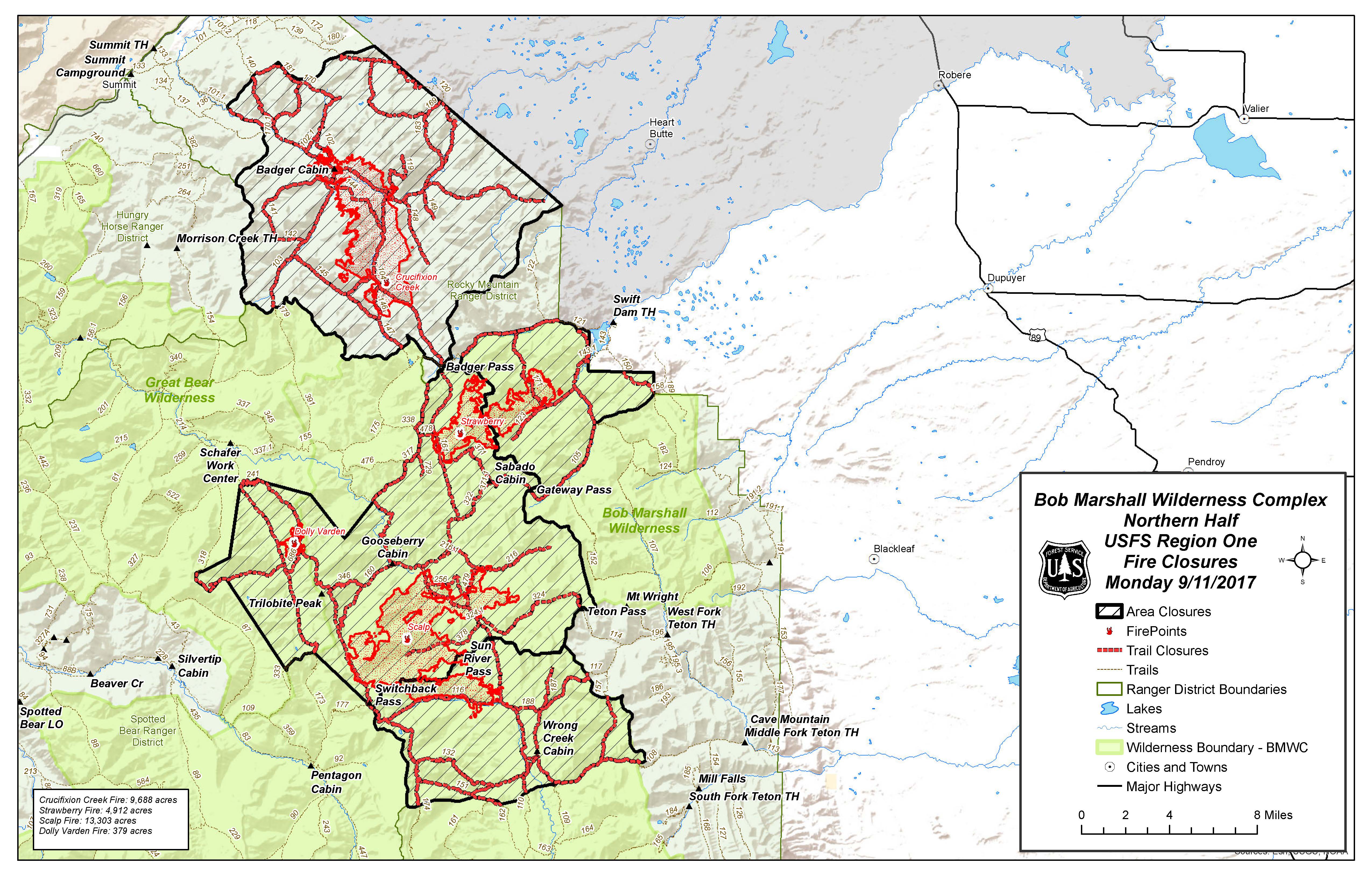
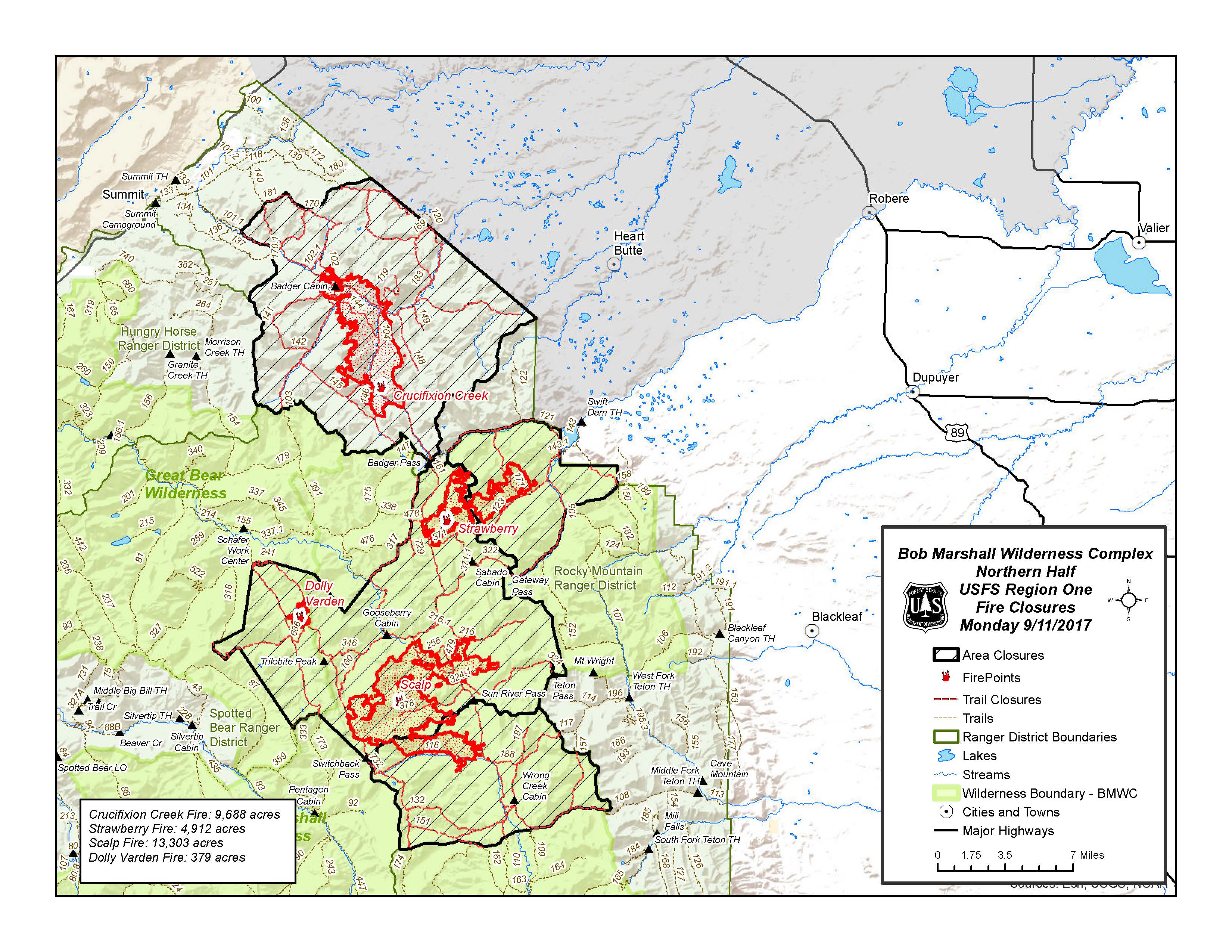
| ComplexClosure_NorthHalf_11x17L_20170911_0930.jpg | 2017-09-11 14:45 | 1.5M | ||
| ComplexClosure_NorthHalf_8x11L_20170911_0930.pdf | 2017-09-11 14:45 | 1.0M | ||
| ComplexClosure_NorthHalf_8x11L_20170911_0930.jpg | 2017-09-11 14:45 | 899K | ||
| Briefing_Topo_34x44port_20170911_1100_TFR_reduced.pdf | 2017-09-11 14:44 | 5.7M | ||
| Briefing_Topo_34x44port_20170910_2100_MTHLF005086_0911day_Reduced.pdf | 2017-09-10 22:16 | 4.4M | ||
| Briefing_Aerial_34x44port_20170910_2100_MTHLF005086_0911day_Reduced.pdf | 2017-09-10 22:16 | 5.2M | ||
| Air_Ops_Topo_34x44port_20170910_2000_Reduced.pdf | 2017-09-11 18:21 | 4.4M | ||
| Air_Ops_Topo_11x17port_20170910_2200.pdf | 2017-09-11 18:21 | 963K | ||