Index of /public/incident_specific_data/n_rockies/Historic_archived NIROPS/2017_fires/2017_Sunrise/Gis_Maps/MAP_PRODUCTS/20170811
Name
Last modified
Size
Description
Parent Directory
-
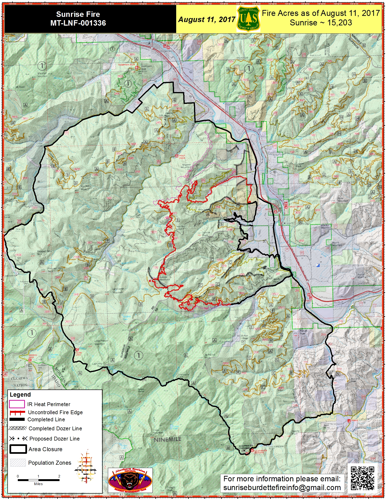
PIO_11x17_port_20170811_0527_Sunrise_MTLNF001336_0811day.jpg
2017-08-11 06:56
4.3M
PIO_11x17_port_20170811_0532_Sunrise_MTLNF001336_0811day.pdf
2017-08-11 06:55
6.5M
airops_11x17_port_20170810_2107_Sunrise_MTLNF1336_0811day.pdf
2017-08-11 06:51
3.3M
IAP_11x17_Index_land_201708011_0504_Sunrise_MTLNF1336_0811day.pdf
2017-08-11 06:51
1.7M
IAP_11x17_MP_land_201708011_0511_Sunrise_MTLNF1336_0811day.pdf
2017-08-11 06:51
7.7M
IR_Briefing_E_20170811_0400_SunriseBurdette_0811_0600_MTLNF.pdf
2017-08-11 06:49
6.6M
IR_Briefing_EZoom_20170811_0400_Burdette_0811_0600_MTLNF001336.pdf
2017-08-11 06:48
3.4M
IR_Briefing_EZoom_20170811_0400_DIV_K_Sunrise_0811_0600_MTLNF001336.pdf
2017-08-11 06:48
17M
IR_Briefing_EZoom_20170811_0400_Sunrise_0811_0600_MTLNF001336.pdf
2017-08-11 06:46
6.8M
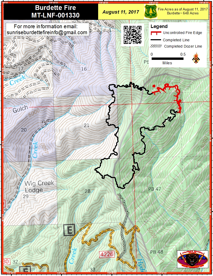
PIO_8.5x11_port_20170811_0529_Burdette_MTLNF001330_0811day.jpg
2017-08-11 06:46
1.0M
PIO_8.5x11_port_20170811_0530_Burdette_MTLNF001330_08011day.pdf
2017-08-11 06:44
2.1M
Transportation_11x17_20170811_0430_Sunrise_0811_0600_MTLNF-001336.pdf
2017-08-11 06:42
19M