| Name | Last modified | Size | Description | |
|---|---|---|---|---|
| Parent Directory | - | |||
| IR_Brief_EZoom_port_20170814_0419_Burdette_MTLNF1336_0814day.pdf | 2017-08-14 06:56 | 8.4M | ||
| IAP_11x17_MP_land_201708014_0500_Sunrise_MTLNF1336_0814day.pdf | 2017-08-14 07:00 | 7.8M | ||
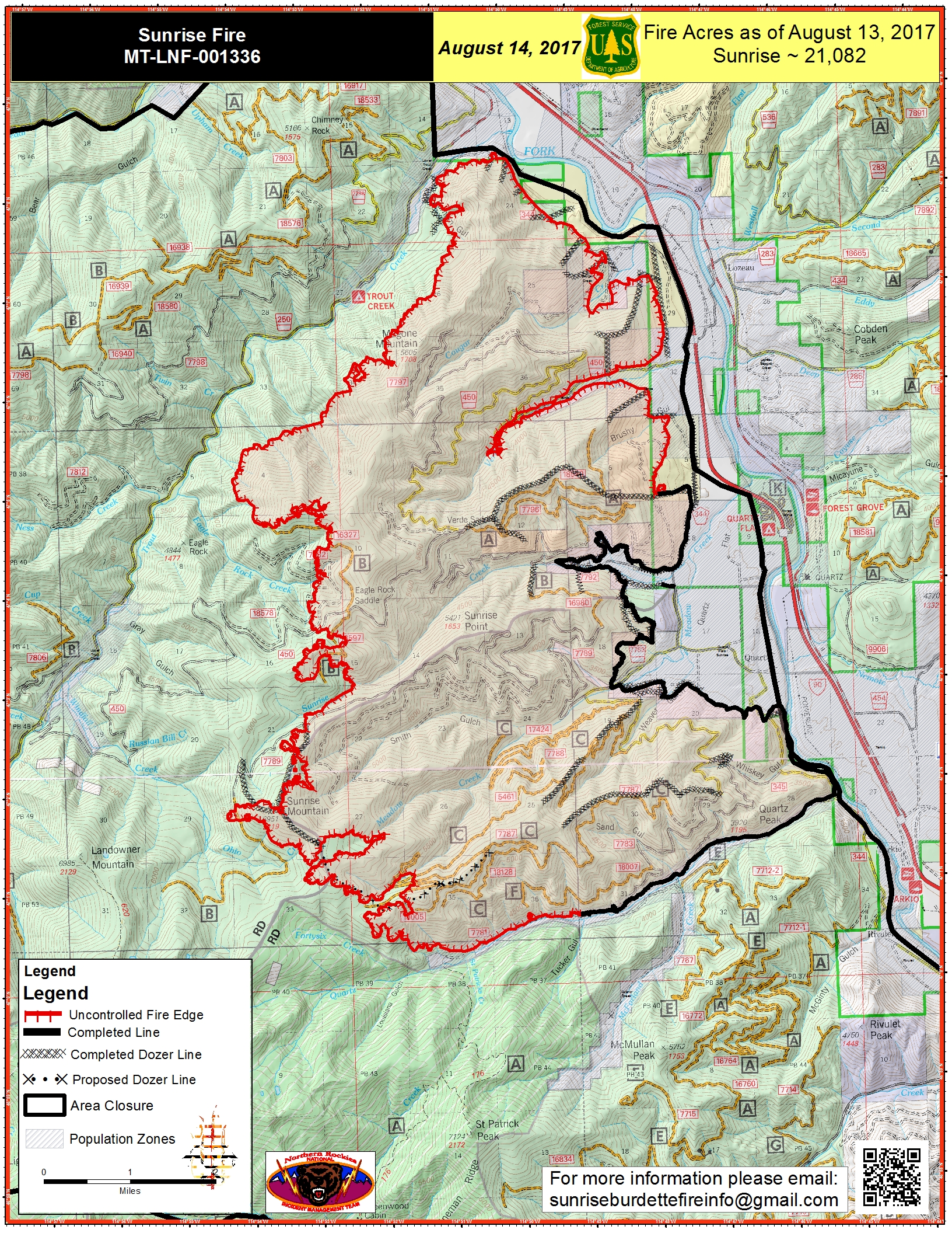
| NEWPIO_20170814_0518_11x17_port_Sunrise_MTLNF001336_0814day.pdf | 2017-08-14 07:00 | 6.7M | ||
| IR_Brief_E_port_20170814_0415_SunriseBurdette_MTLNF1336_0814day.pdf | 2017-08-14 06:56 | 6.3M | ||
| PIO_11x17_port_20170814_0526_Sunrise_MTLNF001336_0814day.pdf | 2017-08-14 07:01 | 5.5M | ||
| Transporttion_11x17_20170814_0515_Sunrise_0814_0600_MTLNF1336.pdf | 2017-08-14 07:02 | 4.3M | ||
| PIO_11x17_port_20170814_0525_Sunrise_MTLNF001336_0814day.jpg | 2017-08-14 07:01 | 4.2M | ||
| airops_11x17_port_20170814_0540_Sunrise_MTLNF1336_0814day.pdf | 2017-08-14 07:02 | 3.2M | ||
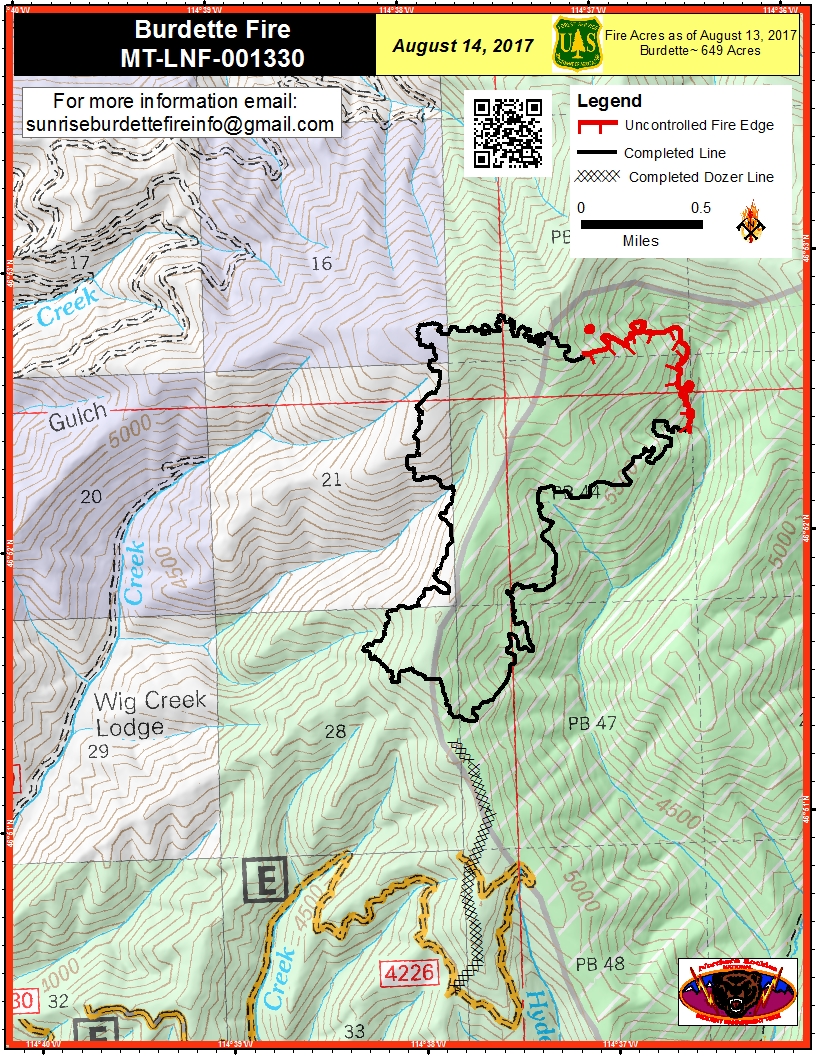
| PIO_8.5x11_port_20170814_0533_Burdette_MTLNF001330_0814day.pdf | 2017-08-14 07:03 | 2.1M | ||
| PIO_8.5x11_port_20170814_0533_Burdette_MTLNF001330_0814day.jpg | 2017-08-14 07:02 | 1.0M | ||
| Thumbs.db | 2017-08-14 07:03 | 22K | ||