| Name | Last modified | Size | Description | |
|---|---|---|---|---|
| Parent Directory | - | |||
| BAM_2017_MillerComplex_ORRSF000647_72x96_0914.pdf | 2017-09-13 23:25 | 4.0M | ||
| Dutch_Creek_BW_20170914_2017_MillerComplex_ORRSF000647_ArchE_land_20170911.pdf | 2017-09-13 23:26 | 2.8M | ||
| IAP_20170914_2017_MillerComplex_ORRSF000647_11x17_land.pdf | 2017-09-13 23:24 | 18M | ||
| OPS_AllFires_20170914_2017_MillerComplex_ORRSF000647_ArchE_land.pdf | 2017-09-13 23:19 | 4.9M | ||
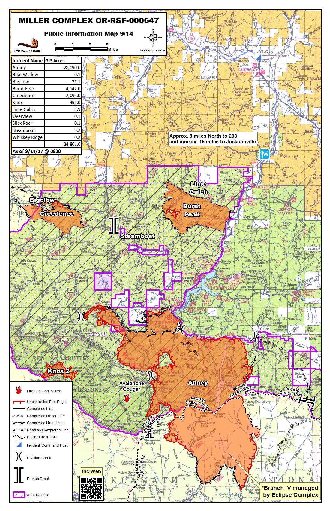
| PIO_20170914_2017_MillerComplex_ORRSF000647_11x17_port.jpg | 2017-09-14 14:05 | 2.3M | ||
| PIO_20170914_2017_MillerComplex_ORRSF000647_11x17_port.pdf | 2017-09-14 14:05 | 1.9M | ||
| Pilot_20170914_2017_MillerComplex_ORRSF000647_11x17_back.pdf | 2017-09-14 15:07 | 199K | ||
| Pilot_20170914_2017_MillerComplex_ORRSF000647_11x17_front.pdf | 2017-09-14 15:07 | 1.3M | ||
| Repair_Abney_20170914_2017_MillerComplex_ORRSF000647_ArchE_land.pdf | 2017-09-16 08:36 | 5.9M | ||
| Repair_AllFires_20170914_2017_MillerComplex_ORRSF000647_ArchE_land.pdf | 2017-09-15 22:38 | 5.4M | ||
| Transportation_20170914_2017_MillerComplex_ORRSF000647_11x17_landscape.pdf | 2017-09-13 23:27 | 1.5M | ||