| Name | Last modified | Size | Description | |
|---|---|---|---|---|
| Parent Directory | - | |||
| 20160726_1200_WRST_521_Steamboat_Creek_VIIRS_Field_Map_17x22_land.pdf | 2016-07-26 18:43 | 6.5M | ||
| 20160726_1500_WRST_521_Steamboat_Creek_IAP_11x17_land.pdf | 2016-07-26 18:43 | 2.7M | ||
| 20160726_1500_WRST_521_Steamboat_Creek_Plans_8x11_port.pdf | 2016-07-26 18:43 | 1.6M | ||
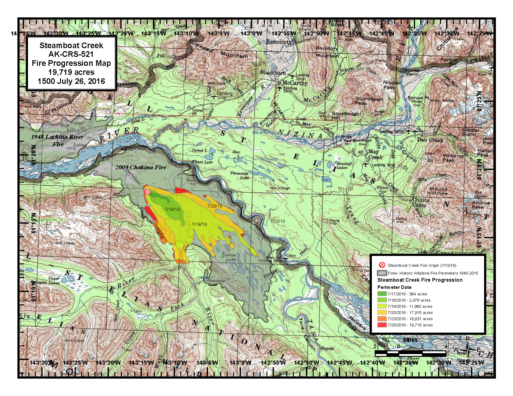
| 20160726_1500_WRST_521_Steamboat_Creek_Progression_8x11_land.jpg | 2016-07-26 18:43 | 1.1M | ||
| 20160726_1500_WRST_521_Steamboat_Creek_Progression_8x11_land.pdf | 2016-07-26 18:43 | 1.6M | ||
| 20160726_1500_WRST_521_Steamboat_Creek_Public_Info_8x11_land.jpg | 2016-07-26 18:43 | 1.1M | ||
| 20160726_1500_WRST_521_Steamboat_Creek_Public_Info_8x11_land.pdf | 2016-07-26 18:43 | 1.6M | ||
| 20160726_1500_WRST_521_Steamboat_Creek_Public_Info_36x48_portrait.pdf | 2016-07-26 18:43 | 22M | ||
| 20160726_1500_WRST_521_Steamboat_Creek_Situation_36x48_portrait.pdf | 2016-07-26 18:44 | 28M | ||
| 20160726_1600_WRST_Vicinity_fires_8X11.jpg | 2016-07-26 18:44 | 1.0M | ||
| 20160726_1600_WRST_Vicinity_fires_8X11.pdf | 2016-07-26 18:44 | 1.0M | ||