| Name | Last modified | Size | Description | |
|---|---|---|---|---|
| Parent Directory | - | |||
| 20070916_IAP_3_DAY_index.pdf | 2016-07-05 13:02 | 71K | ||
| 20070914_pine_wfsa_contingencies_letter_port.pdf | 2016-07-05 13:02 | 411K | ||
| 20070916_IAP_3_DAY_PG2.pdf | 2016-07-05 13:02 | 651K | ||
| 20070916_IAP_3_DAY_PG1.pdf | 2016-07-05 13:02 | 658K | ||
| 20070915_pine_fire_history_let_land.pdf | 2016-07-05 13:02 | 878K | ||
| 20070914_pine_wfsa_contingencies_esize_port.pdf | 2016-07-05 13:01 | 1.4M | ||
| 20070915_pine_progression_e_land.pdf | 2016-07-05 13:02 | 2.0M | ||
| 20070917_0600hrs_pinevalley_fire_briefing_final_fimt.pdf | 2016-07-05 13:02 | 2.0M | ||
| 20070917_pine_rehab_map.pdf | 2016-07-05 13:02 | 2.0M | ||
| 20070915_pine_fire_history_e_lands.pdf | 2016-07-05 13:02 | 2.7M | ||
| 20070915_1600hrs_pine_fire_final_perimeter_DRG_eland.pdf | 2016-07-05 13:02 | 2.9M | ||
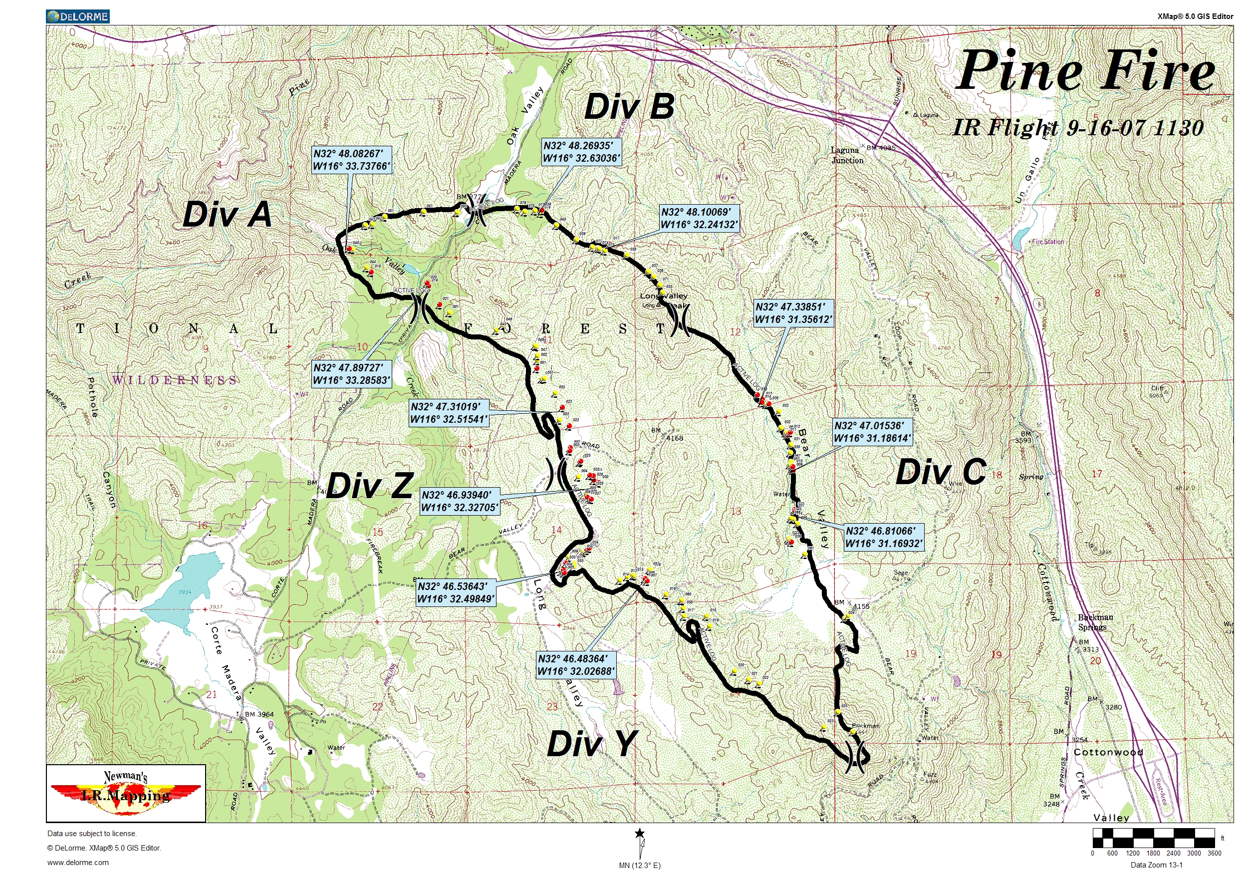
| Pine 9-16-07 1130.jpg | 2016-07-05 13:02 | 5.6M | ||
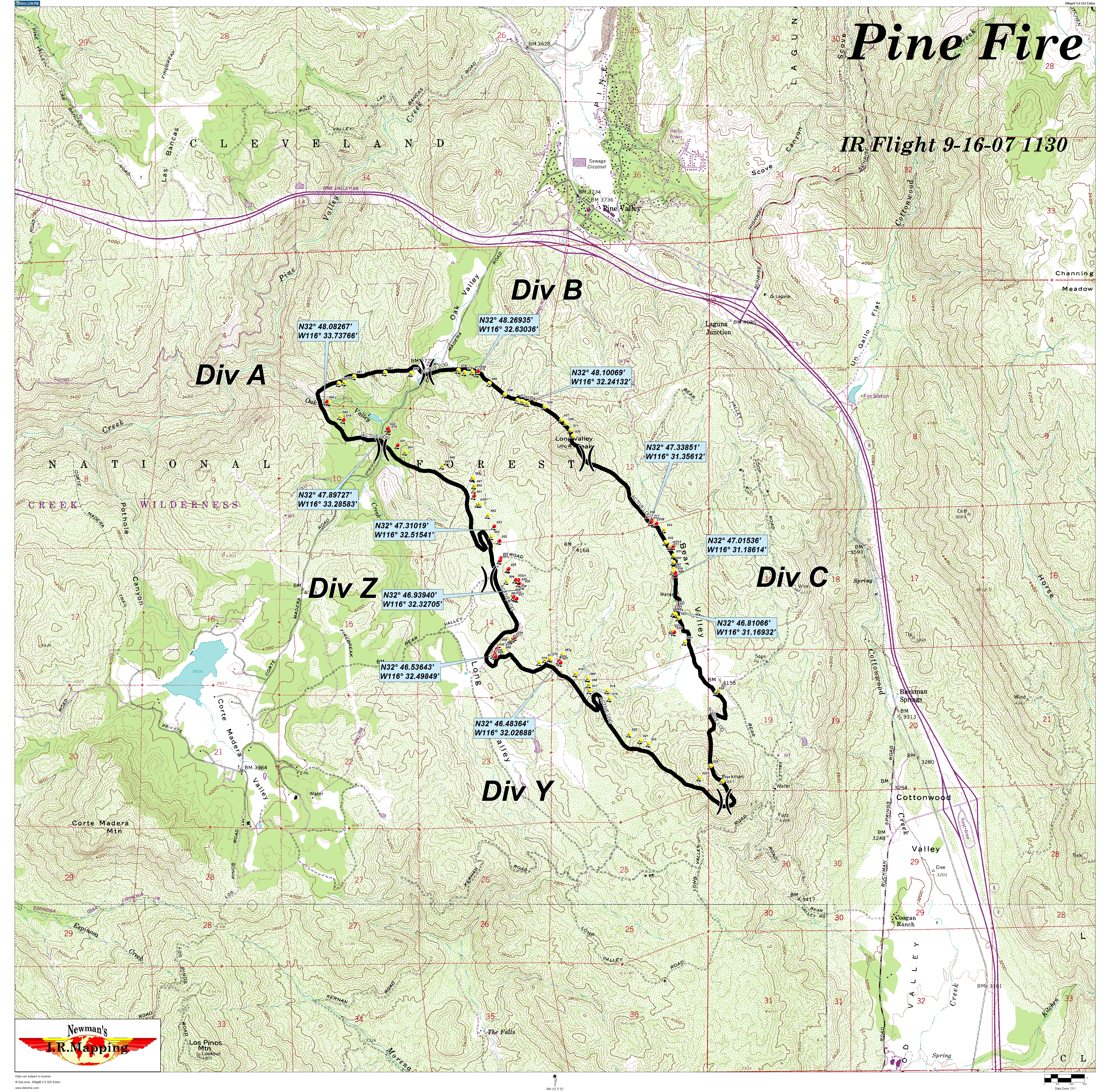
| Pine Color 42x42 9-16-07.jpg | 2016-07-05 13:03 | 19M | ||
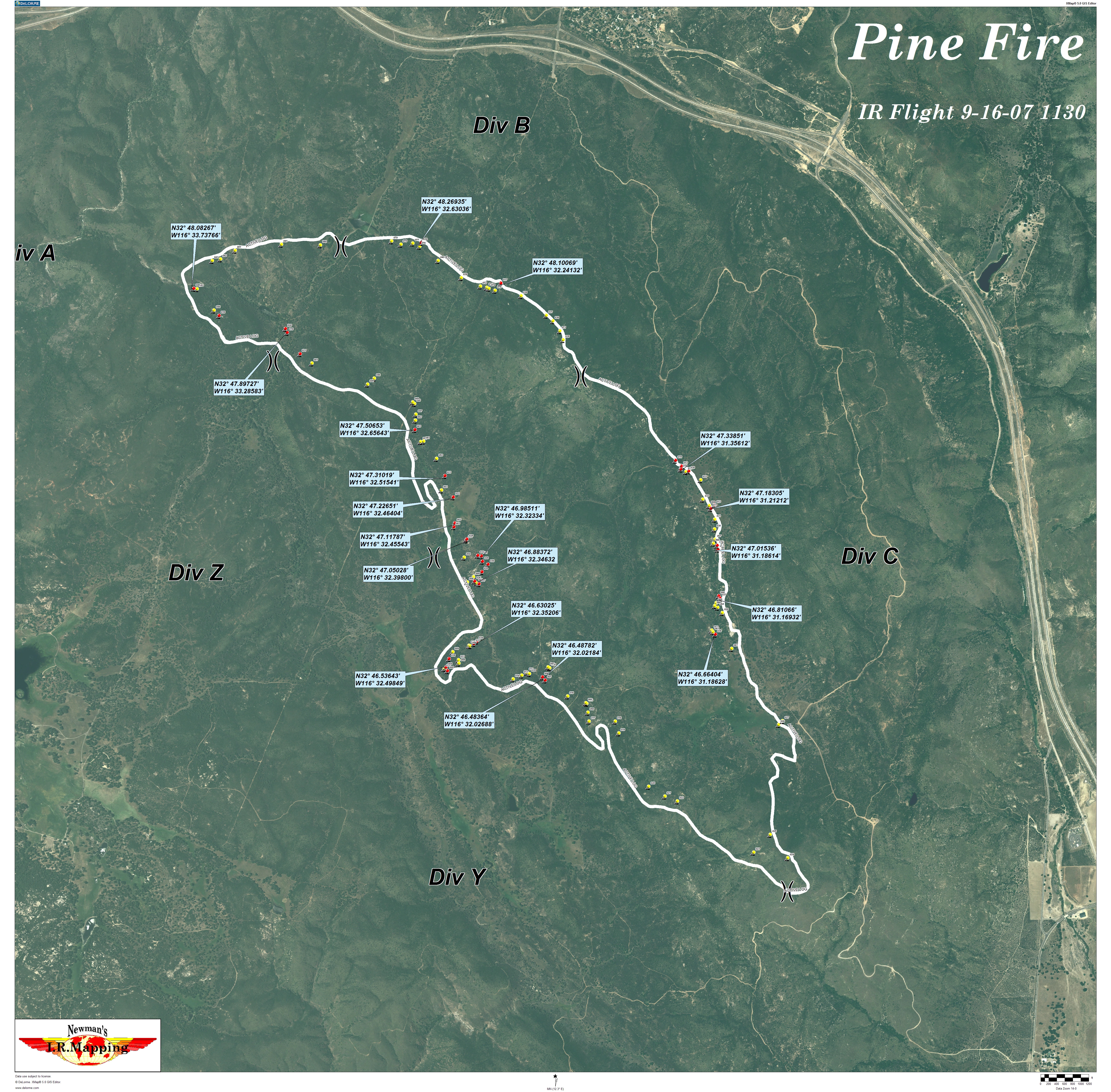
| Pine 42x42 9-16-07.jpg | 2016-07-05 13:02 | 31M | ||