Index of /public/incident_specific_data/n_rockies/Historic_archived NIROPS/2017_fires/2017_Sunrise/Gis_Maps/MAP_PRODUCTS/20170817
Name
Last modified
Size
Description
Parent Directory
-
Airops_11x17_port_20170817_0430_Sunrise_MTLNF1336_0817day.pdf
2017-08-17 06:36
797K
IAP_11x17_Index_land_201708017_0454_Sunrise_MTLNF1336_0817day.pdf
2017-08-17 06:37
1.7M
IAP_11x17_MP_land_201708017_0458_Sunrise_MTLNF1336_0817day.pdf
2017-08-17 06:38
7.9M
IR_BurdetteBrief_archE_port_20170817_0400_MTLNF1336_0817day.pdf
2017-08-17 06:40
11M
IR_SunriseBrief_archE_port_20170817_0400_MTLNF1336_0817day.pdf
2017-08-17 06:41
6.9M
IR_SunriseBurdetteBrief_archE_port_20170817_0400_MTLNF1336_0817day.pdf
2017-08-17 06:42
7.3M
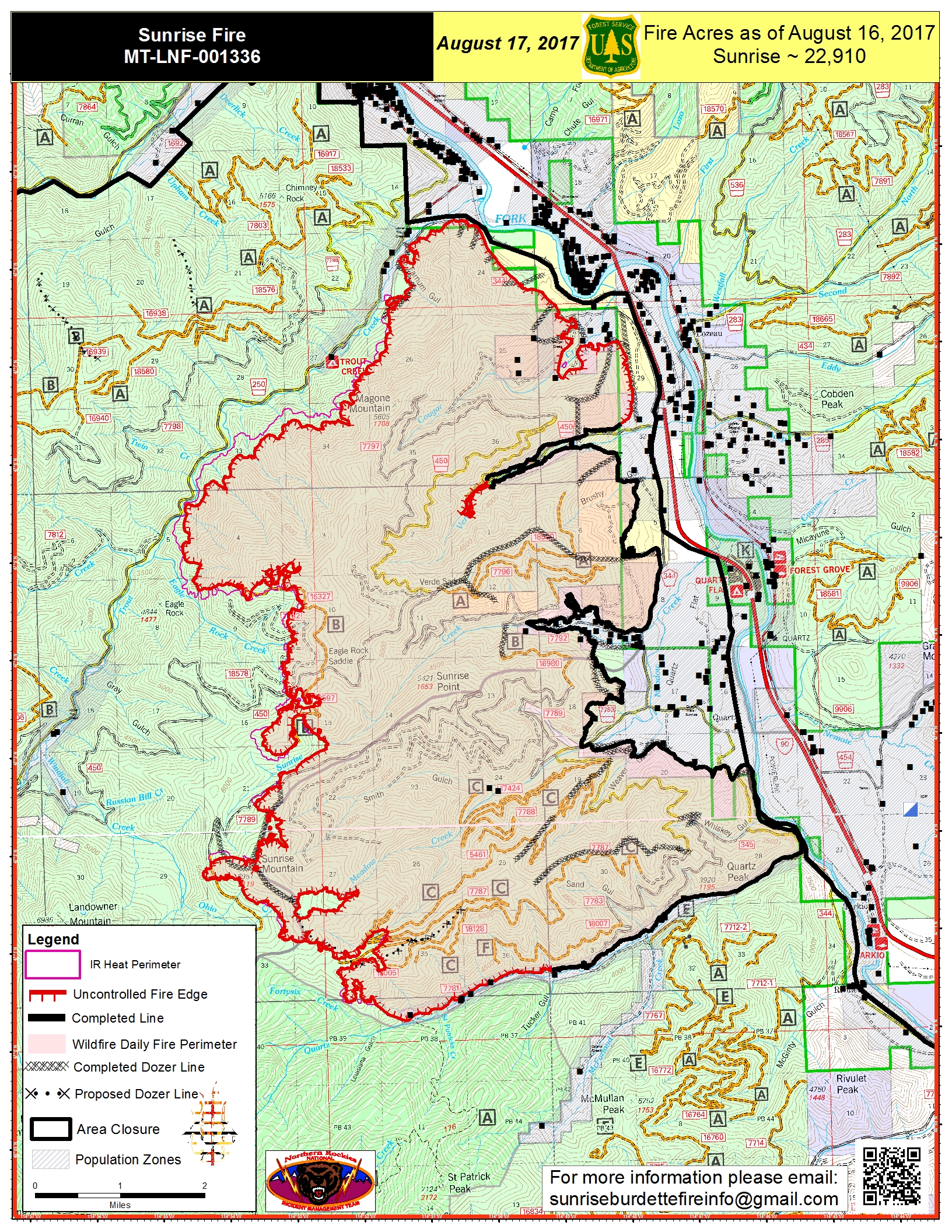
NEWPIO_20170817_0516_11x17_port_Sunrise_MTLNF001336_0817day.jpg
2017-08-17 06:42
4.5M
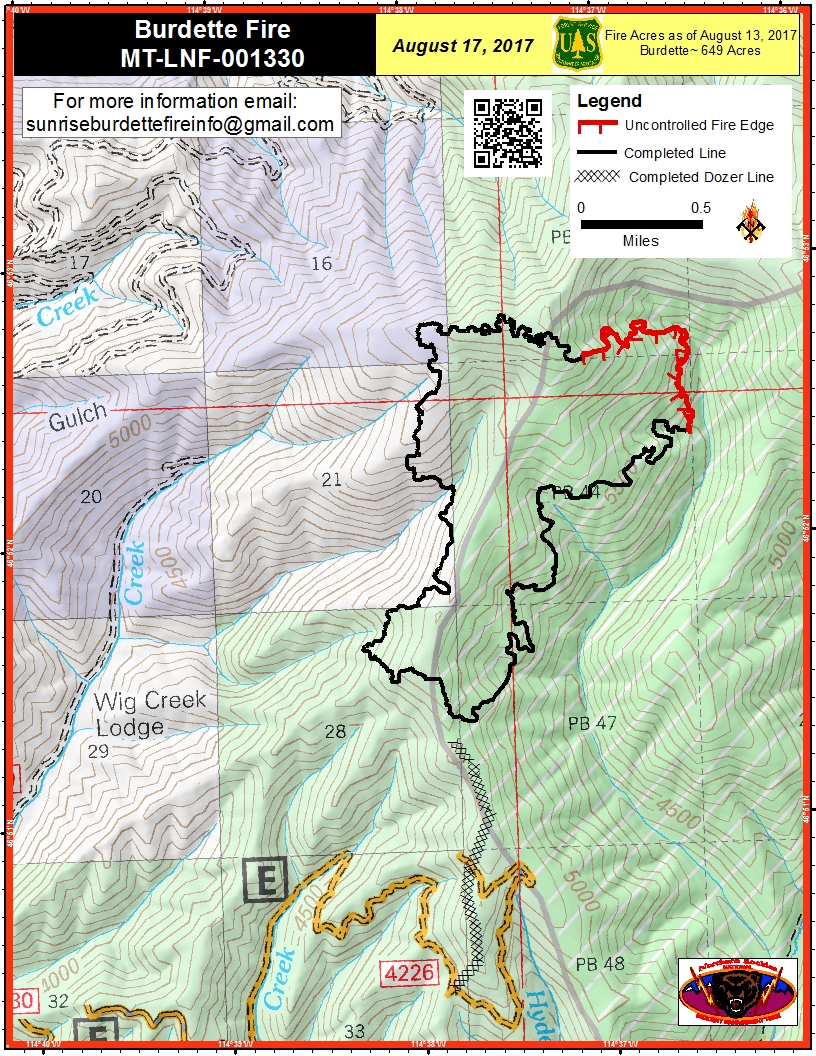
PIO_8.5x11_port_20170817_0527_Burdette_MTLNF001330_0817day.pdf
2017-08-17 06:43
2.1M
PIO_8.5x11_port_20170817_0528_Burdette_MTLNF001330_0817day.jpg
2017-08-17 06:43
1.0M
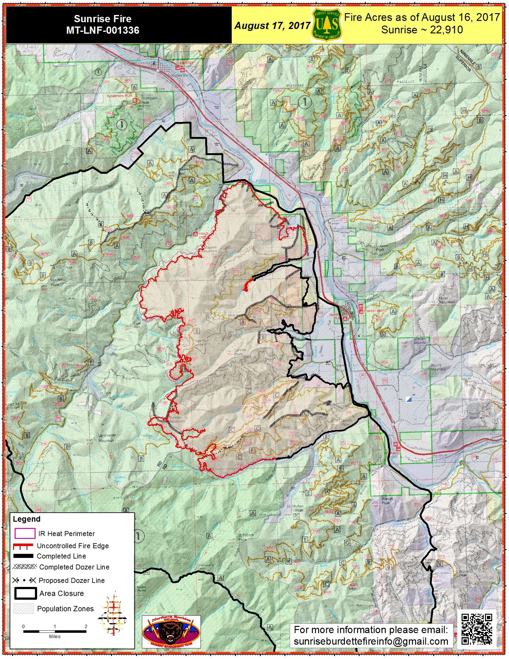
PIO_11x17_port_20170817_0521_Sunrise_MTLNF001336_0817day.jpg
2017-08-17 06:43
4.2M
PIO_11x17_port_20170817_0521_Sunrise_MTLNF001336_0817day.pdf
2017-08-17 06:44
6.2M
Transportation_arch_e_port_20170817_0500_Sunrise_MTLNF1336_0817day.pdf
2017-08-17 06:45
4.3M