Index of /public/incident_specific_data/calif_n/2017 FEDERAL_Incidents/CA-SHF-001770_Helena/BAER
Name
Last modified
Size
Description
Parent Directory
-
Dittymo_arch_e_land_20171007_Helena_CASHF1770.pdf
2017-10-07 15:47
11M
SBS_arch_e_land_20171005_Helena_CASHF1770.pdf
2017-10-05 17:01
8.9M
BaerTreatments_arch_e_land_2017_Helena_CASHF1770.pdf
2017-10-09 23:31
8.8M
StreamCrossingsAtRisk_arch_e_land_20171008_Helena_CASHF1770.pdf
2017-10-08 14:40
8.4M
Watershed_PourPoint_arch_e_land_20171009_Helena_CASHF1770.pdf
2017-10-09 23:31
8.4M
FireHistory_arch_e_land_2017_Helena_CASHF1770.pdf
2017-10-05 17:01
4.4M
SlopeClass_arch_e_land_20171004_Helena_CASHF1770.pdf
2017-10-05 23:11
3.7M
DebrisFlow_basin_arch_e_land_2017_Helena_CASHF1770.pdf
2017-10-07 15:46
3.2M
DebrisFlow_Seg_arch_e_land_20171007_Helena_CASHF1770.pdf
2017-10-07 15:46
3.2M
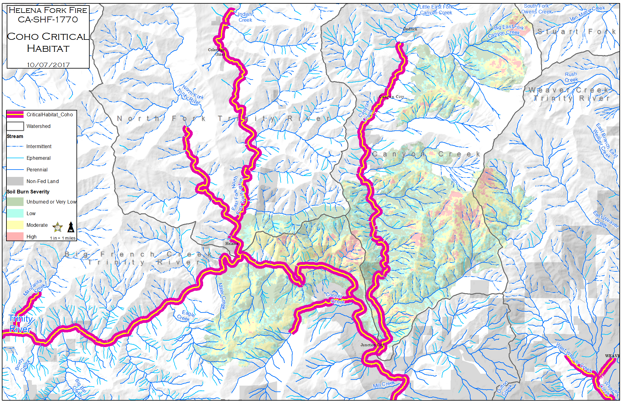
CriticalCoho_85x11_land_20171008_Helena_CASHF1770.png
2017-10-08 19:26
1.6M
Helena_Fork_Fire_Botany10032017.pdf
2017-10-07 15:17
1.6M
SBS.jpg
2017-10-06 12:07
1.3M
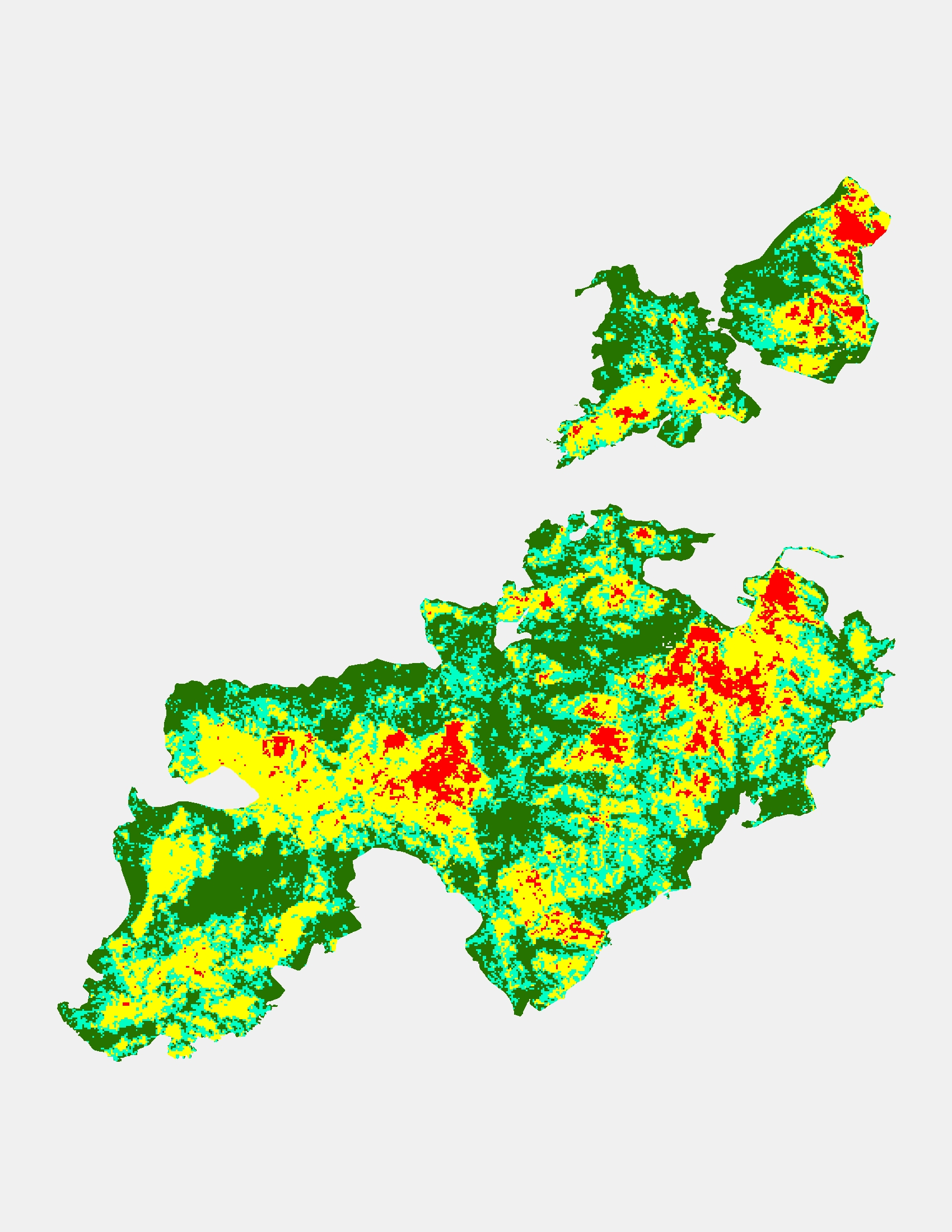
CriticalCoho_HUC_85x11_land_20171008_Helena_CASHF1770.png
2017-10-08 23:27
1.2M
Soil_Burn_Severity.kmz
2017-10-05 17:00
1.2M
CohoCritHab_arch_e_land_20171007_Helena_CASHF1770.pdf
2017-10-07 12:03
1.1M
SBS_HUC.xlsx
2017-10-06 11:49
670K
StreamTable.xlsx
2017-10-08 18:54
514K
sbs_helena_fork_ak_final.zip
2017-10-05 23:08
479K
RoadOwnershipFire.xlsx
2017-10-08 15:46
404K
SBSTableFinal.xlsx
2017-10-05 16:59
339K
dittymo_TribsOfConcern.zip
2017-10-07 16:08
256K
DozerOwnershipFire.xlsx
2017-10-08 15:41
70K
SlopeLength.xlsx
2017-10-05 22:26
69K
HelenaFirePerim_20171004.zip
2017-10-05 23:08
60K
DozerRoadCrossingsOwnership.xlsx
2017-10-08 15:38
24K
DozerIntersectRoads_singlePart_Ownership.zip
2017-10-08 15:40
16K