| Name | Last modified | Size | Description | |
|---|---|---|---|---|
| Parent Directory | - | |||
| Ops_BrI_0825.pdf | 2017-08-25 03:43 | 6.2M | ||
| AirOps_0825.pdf | 2017-08-25 03:44 | 7.5M | ||
| Ops_BrII_0825.pdf | 2017-08-25 03:48 | 6.6M | ||
| Ops_BrIII_0825.pdf | 2017-08-25 03:49 | 6.4M | ||
| Transpo_0825.pdf | 2017-08-25 03:53 | 263K | ||
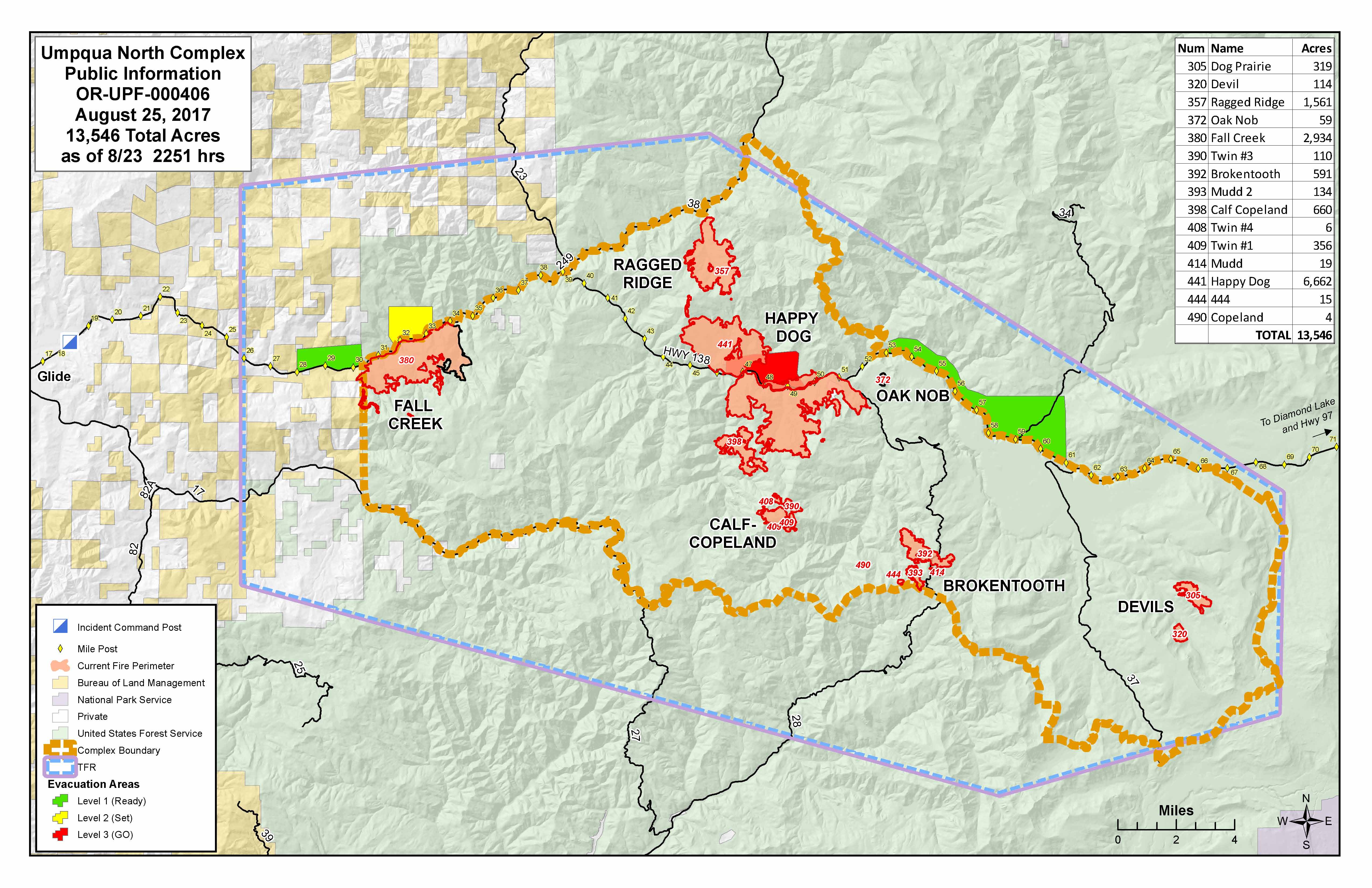
| PublicInfo_20170825_UmpquaNorthComplex_11x17_land1.jpg | 2017-08-25 03:59 | 935K | ||
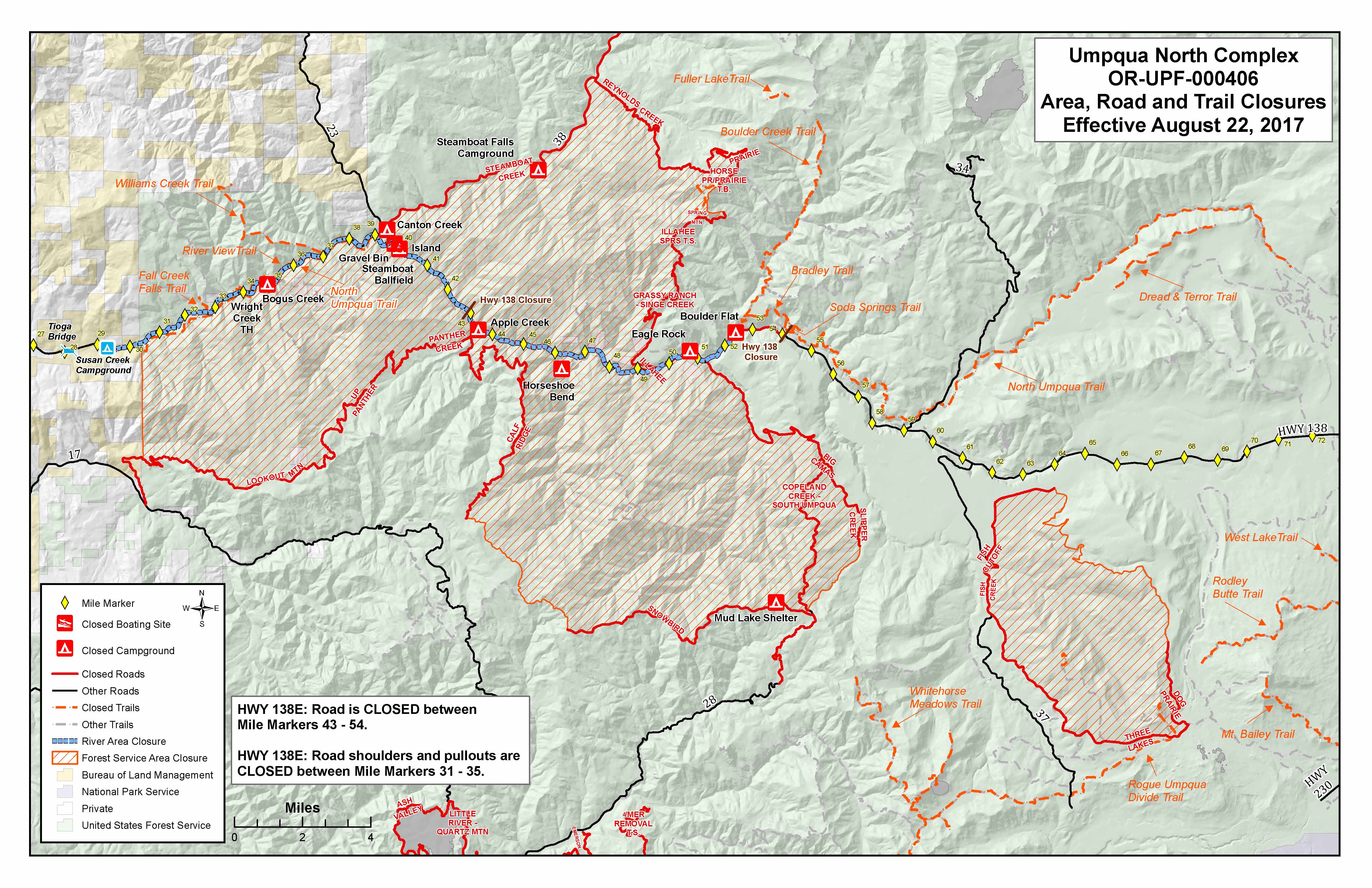
| PublicInfoClosures_20170825_UmpquaNorthComplex_11x17_land.jpg | 2017-08-25 04:00 | 1.2M | ||
| PublicInfo_20170825_UmpquaNorthComplex_11x17_land1.pdf | 2017-08-25 04:00 | 2.3M | ||
| PublicInfoClosures_20170825_UmpquaNorthComplex_11x17_land.pdf | 2017-08-25 04:00 | 3.5M | ||
| Avenza_0825.pdf | 2017-08-25 04:09 | 36M | ||
| Ops_BrIII_Brokentooth_0825.pdf | 2017-08-25 11:34 | 4.6M | ||
| Ops_BrV_0825.pdf | 2017-08-25 11:36 | 7.2M | ||
| Ops_BrV Expanded_0825.pdf | 2017-08-25 11:40 | 9.0M | ||
| Ops_BrIII_Devils_0825.pdf | 2017-08-25 11:42 | 4.2M | ||
| Ops_WholeComplex_825.pdf | 2017-08-25 11:45 | 22M | ||