Index of /public/incident_specific_data/rocky_mtn/2020/PineGulch/IAP/GIS/products/20200902
Name
Last modified
Size
Description
Parent Directory
-
AccountableProperty_ArchD_Land_20200901_2015_PineGulch_COGRD000307_0902Day.pdf
2020-09-01 22:14
1.4M
AccountableProperty_Table_11X17_port_20200831_2139_PineGulch_COGRD000307_0902Day.pdf
2020-09-01 22:14
44K
AirOps_archD_land_20200901_2031_PineGulch_COGRD000307_0902Day.pdf
2020-09-01 22:15
5.9M
AirOpswIR_arch_D_land_20200902_0535_PineGulch_COGRD307_0902Day.pdf
2020-09-02 07:05
5.9M
AreaClosure_archC_Portrait_20200901_1659_PineGulch_COGRD000307_0902_day.pdf
2020-09-01 22:15
2.1M
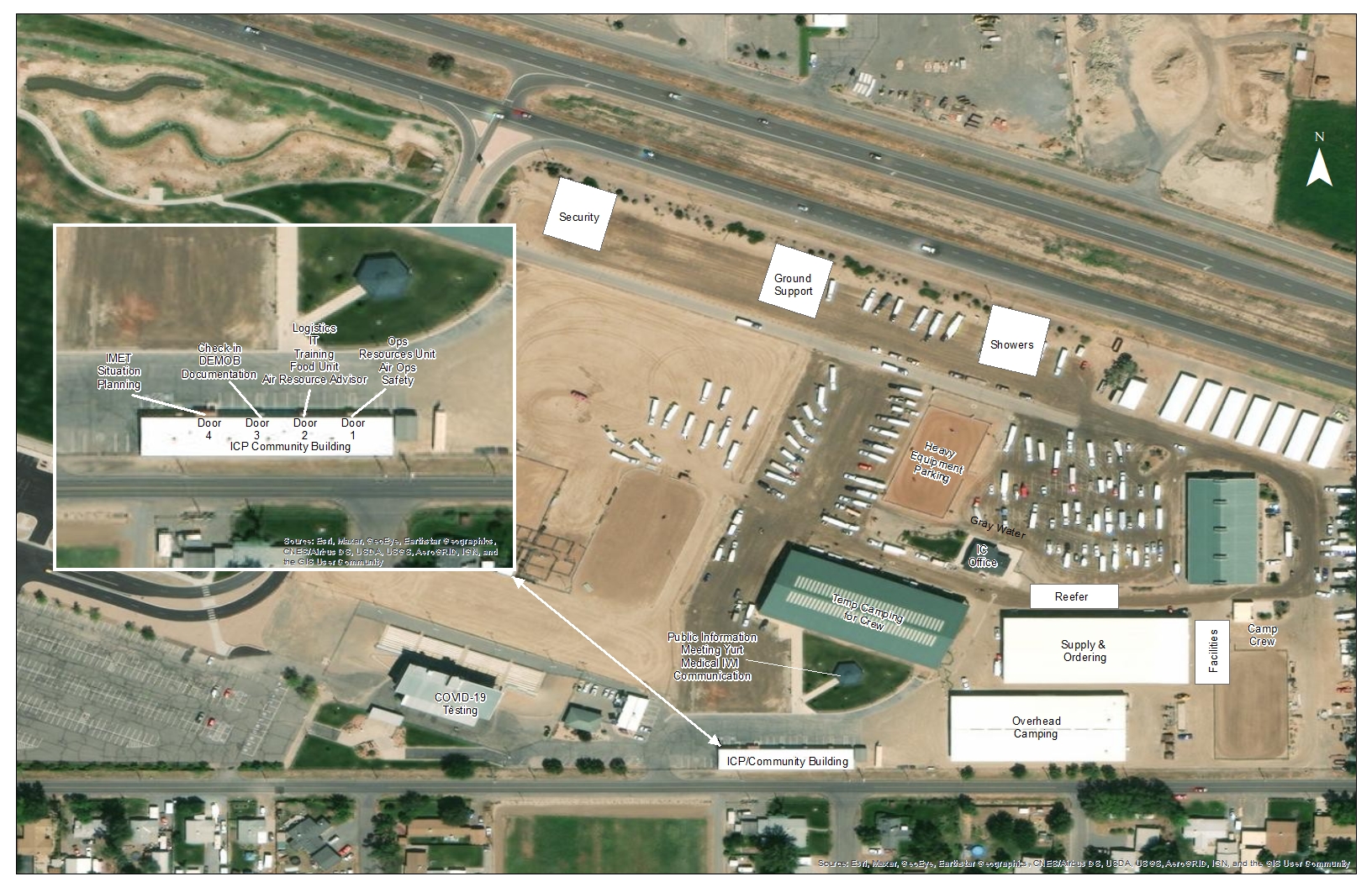
Facilities_11X17_land_20200901_2022_PineGulch_COGRD000307_0902Day.jpg
2020-09-01 22:15
1.1M
Ops_arch_e_land_20200901_2112_Pine Gulch_CO-GRD000307_ArcMap_10_7_1_0902Day.pdf
2020-09-01 22:15
6.3M
Ops_wIR_arch_e_land_20200902_0517_PineGulch_CO-GRD000307_0902Day.pdf
2020-09-02 06:39
5.1M
PIO_AnsiC_Land_20200902_1407_PineGulch_COGRD000307_0902Day.pdf
2020-09-02 15:12
1.0M
PilotMapTable_11X17_port_20200901_2124_PineGulch_COGRD000307_0902Day.pdf
2020-09-01 22:26
94K
PilotMap_11X17_land_20200901_2044_PineGulch_COGRD000307_0902Day.pdf
2020-09-01 22:15
2.1M
PilotMap_wIR_11X17_land_20200902_0601_PineGulch_COGRD000307_0902Day.pdf
2020-09-02 07:09
2.1M
Planning_arch_e_land_20200901_2106_Pine Gulch_CO-GRD000307_ArcMap_10_71_0902Day.pdf
2020-09-01 22:26
2.7M
Planning_wIR_arch_e_land_20200902_0553_PineGulch_0902Day.pdf
2020-09-02 07:05
5.2M
Progression_8x11_Land_20200901_1918_PineGulch_COGRD000307_0902Day.pdf
2020-09-01 22:15
3.8M
Progression_ArchE_Land_20200901_1918_PineGulch_COGRD000307_0902Day.pdf
2020-09-01 22:16
9.9M
SuppressionRepair_ArchEland_20200901_2057_PineGulch_COGRD307_Arc1071_0902_day_opt.pdf
2020-09-01 22:16
13M
Trans_archDport_20200901_2050_PineGulch_COGRD307_0902Day.pdf
2020-09-01 22:17
1.7M
brief_arch_e_land_20200902_ 2037_Pine Gulch_COGRD000307_ArcMap_10_7_1_0902_day_opt.pdf
2020-09-01 22:15
5.1M
iap_11x17_land_20200901_2045_Pine Gulch_COGRD000307_ArcMap_0902_Day_opt.pdf
2020-09-01 22:15
1.4M